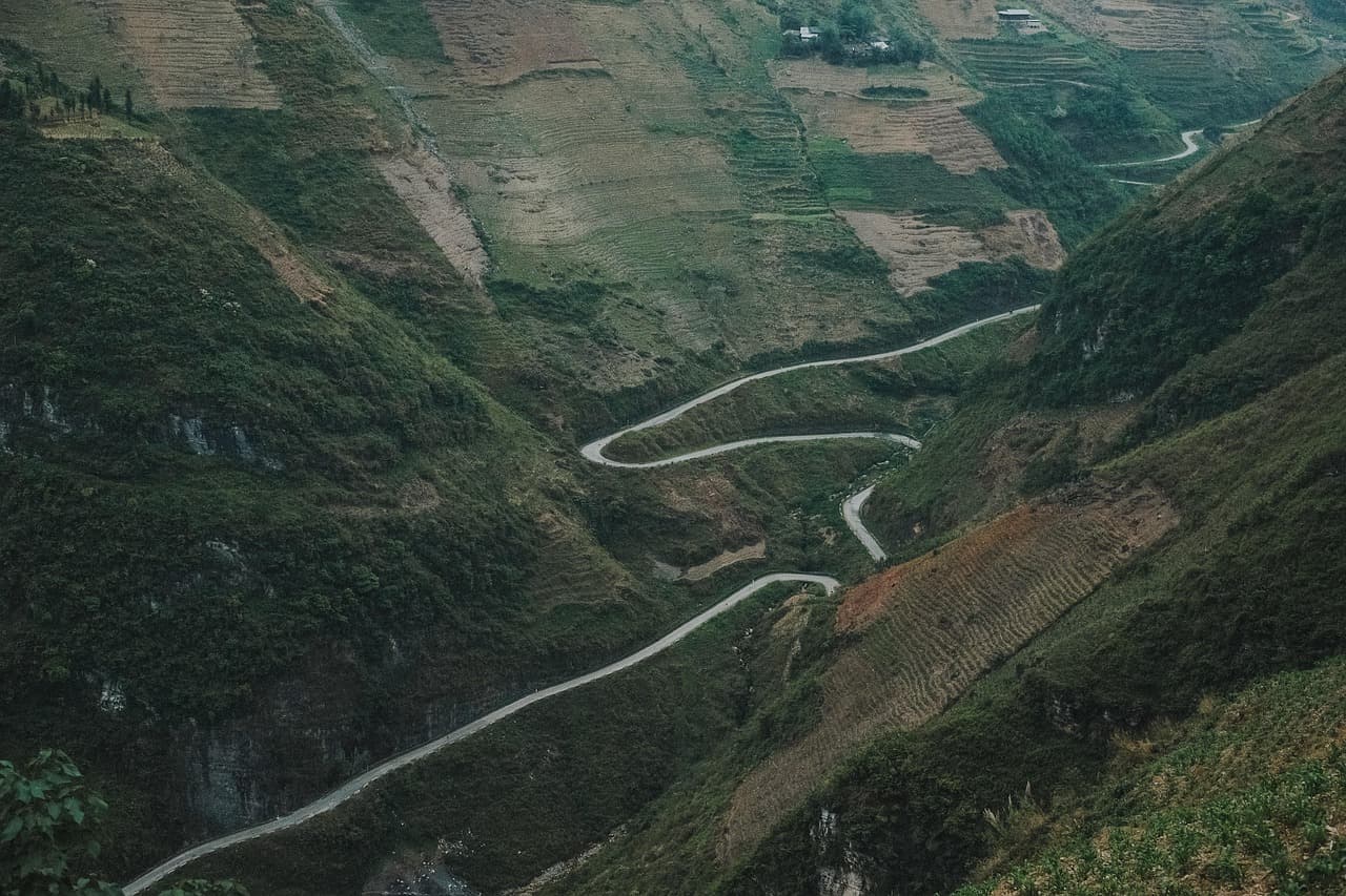
Some roads you watch go by. Others you go through. The Ha Giang loop, in Vietnam's far north, a few kilometres from the Chinese border, belongs firmly to the second kind. Around 350 kilometres of switchbacks carved into limestone, Hmong hamlets clinging to the slopes, and passes where you eventually stop talking altogether.
It has become the most sought-after route in northern Vietnam, and autumn is unquestionably its finest season. Through September and early October, the terraced rice fields turn from green to yellow to gold; from late October to late November, pink buckwheat fields open across the Đồng Văn plateau. The sky clears, clouds settle into the valleys at first light, and the last of the summer rain has washed the dust off the tracks.
Two things have changed recently, and both shape how you plan the trip: Ha Giang is no longer a province, and foreign travellers now need a border-area permit. Here is our 4-day itinerary, updated for the 2026 season, along with everything to sort out before you ride.
Ha Giang or Tuyen Quang? Understanding the region's new name
On 1 July 2025, Vietnam went from 63 provinces to 34. As part of that administrative reform, Ha Giang province was merged with neighbouring Tuyen Quang, and it is the latter name that was kept for the combined entity, with its administrative centre in Tuyen Quang.
In practice this changes almost nothing about your trip, but it is worth knowing so your bookings don't confuse you:
- •The city of Hà Giang still exists and remains the start and end point of the loop.
- •The major sights — Mã Pí Lèng pass, Đồng Văn, Lũng Cú, Mèo Vạc, Hoàng Su Phì — have not been renamed.
- •Some official addresses, hotel invoices and bus tickets now say "Tuyen Quang" where you expected "Ha Giang". If a form asks for the province, Tuyen Quang is the correct answer.
- •The phrase "Ha Giang loop" is still what everyone uses, travellers and local operators alike. It hasn't gone anywhere, and probably won't.
The new border-area permit: the paperwork not to forget in 2026
This is the year's most significant change, and the one that catches the most travellers off guard. Since the beginning of June 2026, foreign travellers must hold a border-area entry permit to travel through the border districts of the former Ha Giang province.
What that means on the ground:
- •The districts concerned are Quản Bạ, Yên Minh, Đồng Văn and Mèo Vạc — in other words, virtually the whole classic loop, including Mã Pí Lèng pass, the Nho Quế river and Tu Sản canyon.
- •The permit is required even if you are only passing through, without spending the night.
- •It costs roughly 200,000 to 250,000 VND, about US$8–10.
- •You can apply for it yourself at the immigration office in Hà Giang city with your original passport, or — far simpler — have your agency, motorbike rental or homestay arrange it.
- •Checks are carried out at the entrance to the border districts. Without a permit, you may be turned back.
Because the rules are recent, they may still evolve: have your local provider confirm the procedure in the days before you leave.
"💬 VietNomads field tip
The permit requires your original passport, and immigration offices close at weekends. So if you roll into Hà Giang on a Saturday morning off the night bus, you can lose a full day. Send a scan of your passport and visa to your homestay or agency two or three days before you arrive: it's the one piece of admin on this trip that we never recommend improvising on arrival.
When to ride the Ha Giang loop
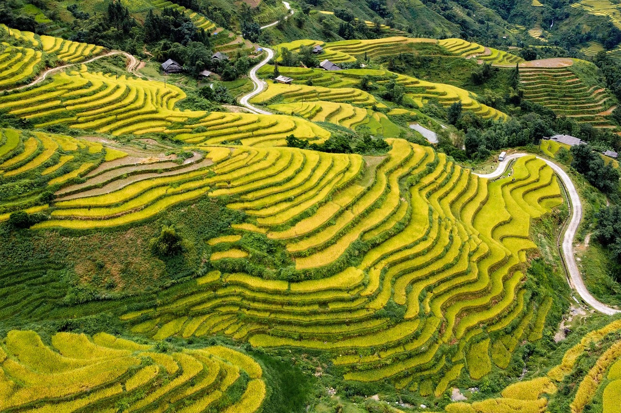
The loop can be ridden year-round, but it is a different place from one month to the next. Here is how we read the calendar.
Mid-September to early October — the golden season. Our favourite window. The rice ripens and the terraces of Quản Bạ, the Yên Minh valley and above all Hoàng Su Phì shift from yellow to gold. The monsoon is ending, the air is washed clean, the light is sharp, and mornings regularly deliver seas of cloud pooling in the valleys. It is also when the roads are at their safest, after the August rains.
Late October to late November — buckwheat season. The fields of tam giác mạch, the highland buckwheat, fill with small white-pink flowers that deepen to rose. Lower-lying plots sometimes open as early as the start of October, but the real bloom on the Đồng Văn plateau, at 1,400 to 1,600 metres, runs from late October to late November. Bring warm layers: nights drop below 12°C without much trouble.
December to February — cold, fog and winter blossom. The plateau can fall to 5°C or lower, with stubborn fog that can hide the views for days at a time. In exchange, the plum and peach trees flower in late January and February, ahead of Tết, and the villages are magnificent.
March to May — dry and green. Mild temperatures, excellent visibility, little rain. A very good alternative if autumn doesn't fit your calendar.
June to August — the rainy season. The landscapes are an electric green and the paddies have just been flooded, but the downpours are violent and landslides are common on the passes. For travellers who can stay flexible with the plan.
The itinerary at a glance
Four days is the right format: long enough not to spend the trip staring at the tarmac, short enough to slot into a wider Vietnam route.
- •Day 1 — Hà Giang → Quản Bạ → Sủng Là → Đồng Văn (about 150 km)
- •Day 2 — Đồng Văn → Lũng Cú → Lô Lô Chải → Đồng Văn (about 80 km)
- •Day 3 — Đồng Văn → Mã Pí Lèng pass → Nho Quế river → Mèo Vạc (about 60 km)
- •Day 4 — Mèo Vạc → Mậu Duệ → Du Già → Hà Giang (about 150 km)
A three-day version exists, but it sacrifices either the Lũng Cú day or the boat trip through Tu Sản canyon. If three days is all you have, drop Du Già and return directly from Mèo Vạc to Hà Giang.
Day 1: from Hà Giang to Đồng Văn over the Quản Bạ and Tham Mã passes
You leave Hà Giang on highway QL4C, which starts climbing almost immediately. First stop some forty kilometres on, at Cổng Trời Quản Bạ, the "Heaven's Gate": from the platform you look out over the Tam Sơn valley and the perfectly rounded twin hills of Núi Đôi, sitting in the middle of the rice fields.
The road then strings together its set pieces. Tham Mã pass with its tight hairpins, followed by Chín Khoanh pass — literally "nine bends" — deliver two of the day's finest viewpoints within a few kilometres of each other. You cross the Sủng Là valley, often called the prettiest on the plateau, and the village of Lũng Cẩm, where you can visit the old rammed-earth house made famous by Vietnamese cinema.
Shortly before Đồng Văn, take the detour to Sà Phìn and the Hmong King's palace (Dinh Vua Mèo), a residence built in the early twentieth century by the Vương family — a striking blend of Chinese architecture and local stone.
You reach Đồng Văn in the late afternoon. Allow six to seven hours with stops: the distance is short, but this road never lets you ride fast.
Day 2: Lũng Cú, the northernmost point of Vietnam
A short day in kilometres, a long one in feeling. From Đồng Văn, some thirty highly photogenic kilometres lead to the Lũng Cú flag tower, planted on Rồng mountain at the country's northern tip. A few hundred steps, an enormous 54 m² Vietnamese flag — one square metre for each of the country's ethnic groups — and, on a clear day, a 360° view over the border valleys.
Two kilometres away, the village of Lô Lô Chải deserves at least a long lunch. Its rammed-earth, tile-roofed houses have been restored by the Lô Lô community, several families run homestays, and a café set inside an old house serves one of the best-placed coffees in Vietnam.
On the way back, take time to wander the old quarter of Đồng Văn: an arcaded square and a stone market hall from the early twentieth century. If your visit falls on a Sunday morning, don't miss the market — families come down from the hamlets at dawn in traditional dress, and the atmosphere bears no resemblance to the rest of the week.
Day 3: Mã Pí Lèng pass and Tu Sản canyon
This is the day you'll remember. Barely twenty kilometres separate Đồng Văn from Mèo Vạc, but they run over Mã Pí Lèng pass, widely considered one of Vietnam's most beautiful roads.
Its other name tells you everything about its history: the "Happiness Road" (Đường Hạnh Phúc), cut by hand into the cliff face between 1959 and 1965 by thousands of workers from several northern ethnic groups, using nothing but hammers, chisels and baskets. Six years of labour for a mountain road you now cross in an hour.
From the viewpoints along the pass, you look straight down onto the Nho Quế river, a turquoise ribbon wedged 700 to 800 metres below between vertical walls. Drop down to the Tráng Kim pier for the boat — or kayak — trip through Tu Sản canyon, the deepest in Southeast Asia. Budget an hour on the water, at a modest price per person.
End the day in Mèo Vạc, a small plateau town that holds its market on Sunday morning and stays far quieter than Đồng Văn.
Day 4: Du Già, the valley that slows you down
The return leg isn't a formality, it's a stage in its own right. The road from Mèo Vạc towards Mậu Duệ and then Du Già is narrower, far less travelled, and runs through terraced rice fields and Tày and Hmong villages that tour buses never reach.
Du Già has become the loop's decompression stop: a green valley, a waterfall with a turquoise pool you can swim in, and a handful of homestays serving dinner communally at long tables. Plenty of travellers add an extra night here — and it's easy to see why.
From Du Già, about a hundred kilometres remain to Hà Giang, usually arriving late afternoon, in time for the night bus back to Hanoi.
Extending the loop: Hoàng Su Phì and its seas of cloud
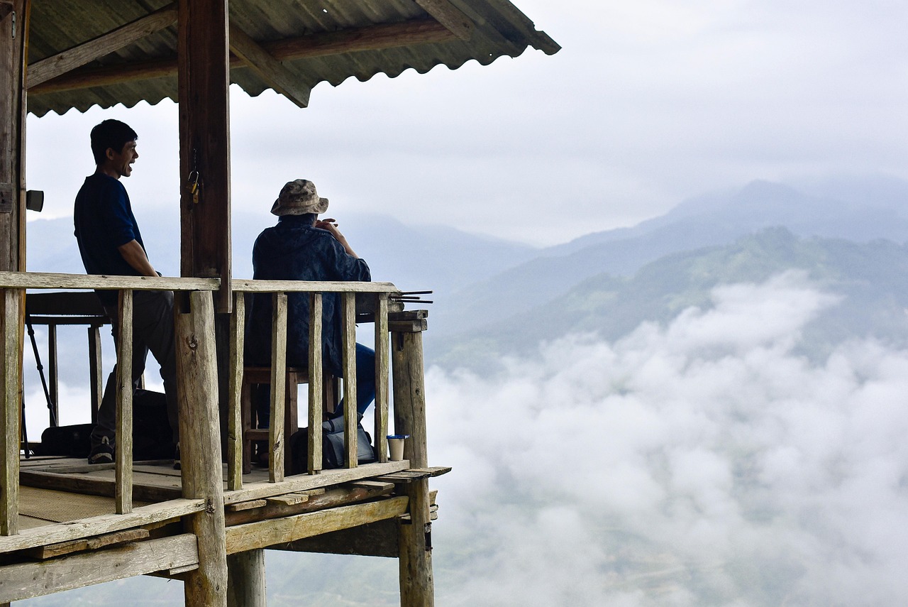
If you have two extra days, add Hoàng Su Phì, west of Hà Giang. It's a different face of the region: less bare limestone, more terraced rice, entire hillsides sculpted into staircases around Bản Phùng, Bản Luốc and Thông Nguyên.
It's also where the cloud seas put on their show. At daybreak in autumn, the valleys fill with mist and the ridges emerge like islands. The best-known viewpoints are on Chiêu Lầu Thi, a summit topping 2,400 metres where several homestays let you sleep on site and be in position for the first light.
The right window for Hoàng Su Phì is the same as for the loop: mid-September to early October, when the rice is ripe.
Motorbike, easy rider or car: which option to choose
Three options, and there's no wrong answer — only the one that matches your experience.
Riding yourself. The freest and the most demanding. The gradients are steep, gravel is common, fog can come down in ten minutes and trucks cut the corners. This is not a road to learn to ride on. Budget roughly 250,000 to 350,000 VND a day for a well-maintained semi-automatic.
The easy rider. You ride pillion behind a local driver who knows every bend, stops in the right places and doubles as a guide. It's the most popular formula on the loop and, honestly, the most sensible one for most travellers: you get to look at the landscape instead of the tarmac. For three to four days all in — driver, accommodation, meals, entry fees — rates vary noticeably between operators and seasons, so ask for an itemised quote.
Car with driver. Ideal with family, with children, for travellers who prefer comfort, or in the rainy season. Every major stop on the loop, Mã Pí Lèng included, is reachable by car.
"💬 VietNomads field tip
If you plan to ride yourself, note that Vietnam only recognises international driving permits issued under the 1968 Vienna Convention, and only with the motorcycle category matching the engine size you rent. Without that document, your travel insurance stands a good chance of refusing any claim after a fall — and falls on this loop are unremarkable. That's the main reason we steer most of our travellers towards an easy rider or a car with driver.
Getting to Hà Giang from Hanoi
Hà Giang has no airport and no railway station: you arrive by road, about 300 kilometres from Hanoi, or six to seven hours.
- •The "limousine" sleeper bus is the standard solution. Departures from Hanoi during the day and, above all, in the evening between 7.30pm and 9pm. Night buses reach Hà Giang around 4 or 5am; most homestays will let you sleep a few hours and shower before the loop starts.
- •A private car costs more but lets you leave when you want and stop along the way.
- •Book your return bus when you book the outbound, especially from September to November and around Vietnamese public holidays: seats go fast.
Budget, accommodation and what to pack
Accommodation. Homestays on the loop range from simple dorms to private rooms with a valley view. Đồng Văn and Mèo Vạc also have small hotels. In the autumn high season, book at least two to three weeks ahead: Lô Lô Chải and Du Già fill up very early.
Money. ATMs are effectively limited to Hà Giang, Đồng Văn and Mèo Vạc. Many homestays, roadside kitchens and boatmen take cash only, and QR-code payment — ubiquitous elsewhere in Vietnam — assumes a local bank account. Carry enough cash for the whole loop.
In the bag. A fleece or light down jacket — the plateau sits between 1,000 and 1,600 metres and evenings are cool from October onwards — a rain shell, gloves, sunscreen, a headtorch (power cuts happen), your original passport for the checkpoints, and motion-sickness tablets if you're prone: four days of hairpins do add up.
Our final tips for a successful loop
- •Plan four days rather than three. The loop can be completed in three days, but it is lived in four.
- •Leave early every morning. The light is better, the mist lifts, and you avoid riding at dusk — something to steer well clear of on these roads.
- •Time your visit around a market day. Đồng Văn and Mèo Vạc hold their markets on Sunday morning; other plateau markets rotate over a few days. Ask your homestay for the exact calendar.
- •Ask before you photograph. The hamlets you ride through are not scenery, and a smile beats a telephoto lens.
- •Don't overload the plan. On the Ha Giang loop, the best decision of the trip is often to stay an extra hour at the same pass.
Planning a trip to northern Vietnam this autumn and unsure about the format, the length, or how to link it with the rest of the country? Tell us about your project: we build every itinerary to measure, border permit and logistics included.